


Pomos Reservoir
This circular walk encompasses far-reaching views around Pomos reservoir and its surrounding mountains. There are two walks, 11.1 or 7.3kms in length, both include circling the reservoir and one short but steep ascent. To reach the starting points take the coast road from Polis to Pomos for around twenty minutes. Pass through Agia Marina and Nea Dimmata and on reaching Pomos village turn right off the main road signposted to Stavros tis Psokas and the Panagia Chrysopateritissa church.
The longer walk starts 1.1km from the turn-off – park just before a concreted track sloping 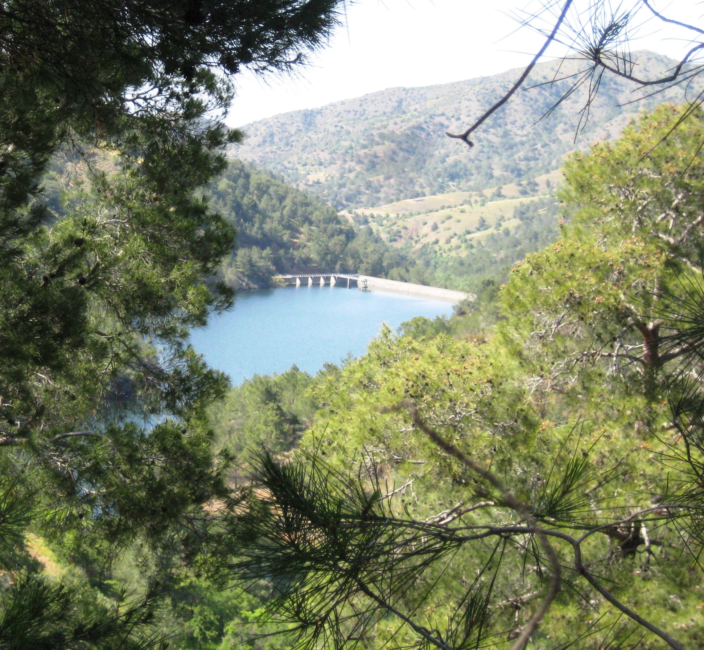 down to the left. Disused telegraph poles mark the location. Stay on the concrete track ignoring any unsurfaced ones heading down across the river. After 7mins/400metres the concreted track forks right and uphill. Keep straight on. The track becomes largely unsurfaced now and follows the river gently up the valley through natural woodland. After a further 20mins. look out for a large citrus grove on your right. Here a vehicle track forks left down to the river (30mins/1.9km). (The Combined walk for long and short routes starts here.)
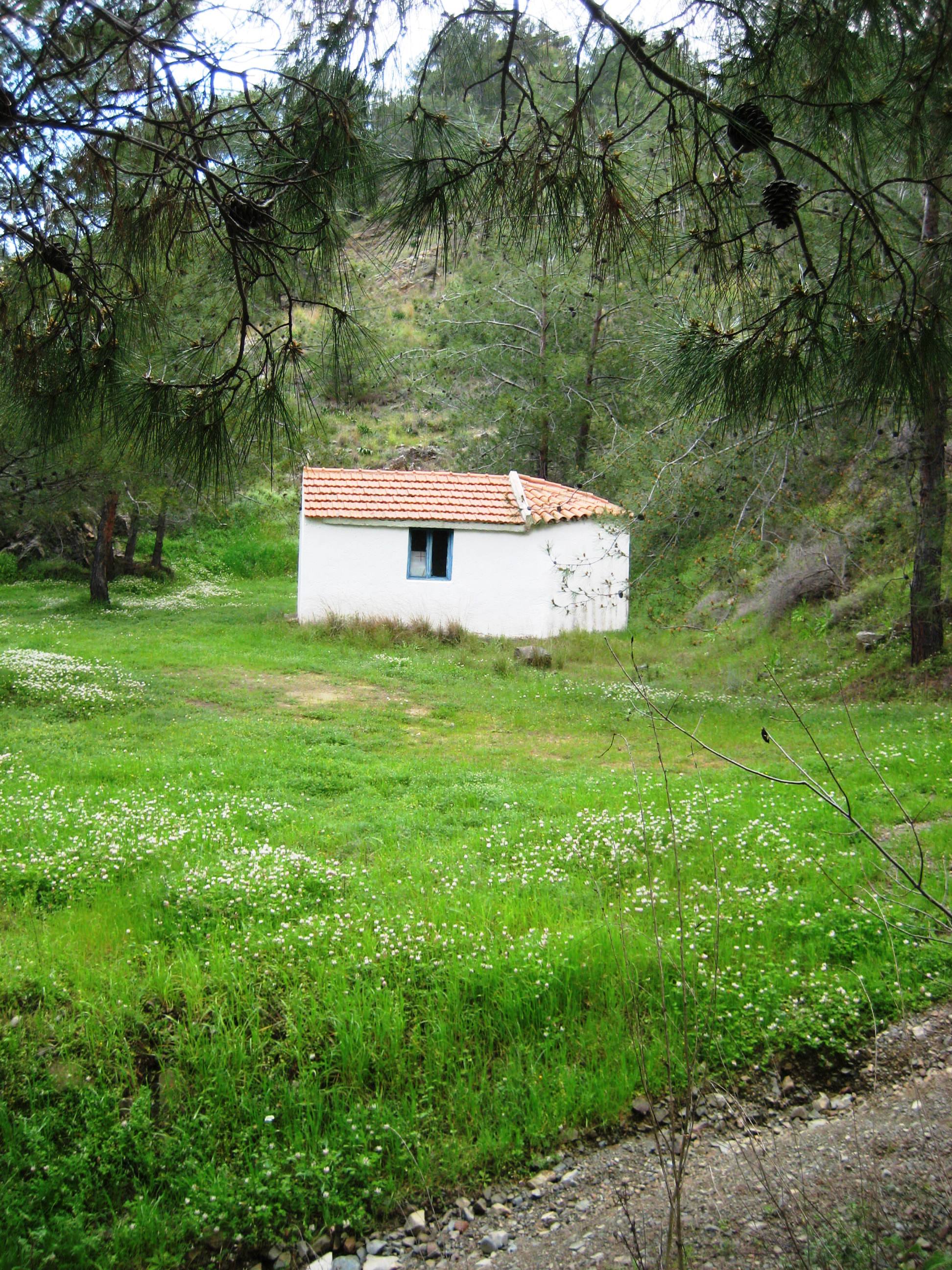
Head down this vehicle track and cross the river (usually flowing well in the early part of the year). Turn immediately right to follow the riverside into woodland, which gradually thickens. On reaching a track fork, bear left (45mins/2.8km), the right fork crosses back over the river. Ahead is the start of a steep ascent for around ten minutes. As you climb you pass a tiny church in a clearing on the left dedicated to Agia Thekla. Take the first turning to the right onto a level track and, after a breather, continue along this forestry vehicle access that generally follows the contours of the hillside with the reservoir gradually coming into view way below.
At 1hr 5mins/3.50km the dam wall is passed. The track dips for a while with views across the water to an old church and a picnic site behind which the hillside soars to nearly 600 metres. Slightly upwards again before a continuous descent beyond the tail end of the reservoir. After crossing the river bridge a main trackway is reached (1hr 45mins/5.85km). Turn right and downhill. After crossing over the Livadhi river bear right past the track signposted to Livadhi and up to a picnic site (2hrs 5mins/7.3km). The short walk ends here. The nearby church, Panagia Chrysopateritissa, formerly a monastery, dates back to the early 16th century. Set in tranquil woodland, both church and cemetery are worth a visit.
The long walk continues steadily downwards along the tarmac road. On the way note the derelict stone buildings scattered along the opposite hillside. Generally known as Paliambela, the last inhabitants left the area for Pomos in the late 1950s. Hidden away above is yet another church, this one dedicated to Panagia Chrysoeleousa. Your starting point is reached at 3hrs/11.4kms.
The shorter walk commences at the picnic site by the church overlooking the reservoir, reached after around sixteen minutes’ drive from the right turn in Pomos along a twisty but scenic tarmac road. Walk back along the tarmac and 200m after the dam wall, on the apex of a left hand bend, take a sharp right turn down an unsurfaced track. At the bottom go sharp left. Follow the track winding through woodland which crosses over a disused aqueduct several times. Ignore a track descending to the right. Shortly after a smallholding there is a fine stand of prickly-pear bushes. On reaching a large citrus grove on your left, take the vehicle track leading down to the river (30mins/2km) From this point follow the Combined walk details described above arriving back at the picnic site after 2hrs 5mins/7.3kms.
From the picnic place two linear walks may also be of interest. Head inland and take the left turn over the river bridge to head gently up the valley for around four kilometres to a tarmac road junction. From here there are extensive views down towards Morphou Bay. The tarmac road straight ahead leads directly down to Pano Pyrgos.
Alternatively, from the picnic site take the track up the right-hand valley. After some six and a half kilometres another picnic site is reached. Here was the village of Livadhi long since abandoned and overtaken once more by the forest.
By Colin Gorton©, member of the Phoenix